Public Spaces Protection Order 2026
Public Spaces Protection Order (PSPO) 2026
The Anti-Social Behaviour Crime and Policing Act 2014 introduced new powers for councils to tackle anti-social behaviour (ASB). One of these powers was the ability to introduce PSPOs to restrict certain activities or behaviours within a defined area, if it could be shown that such activity was having a negative impact on the local community.
PSPOs give police and council officers additional powers to take enforcement action against people who cause ASB in public places.
PSPOs are designed to ensure that members of the public can use and enjoy public spaces without experiencing anti-social behaviour.
The Council, in making this Order, is satisfied on reasonable grounds that:
- The activities identified below have been carried out in public places within the Council’s area, and have had a detrimental effect on the quality of life of those in the Locality, and that:
the effect, or likely effect, of the activities:- is, or is likely to be, of a persistent or continuing nature
- is, or is likely to be, such as to make the activities unreasonable, and justifies the restrictions imposed by the notice.
Alcohol
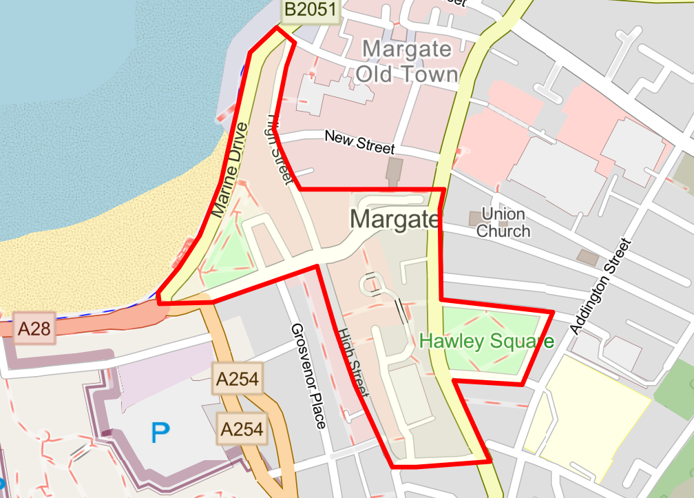
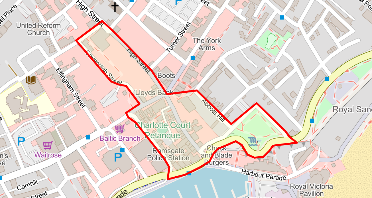
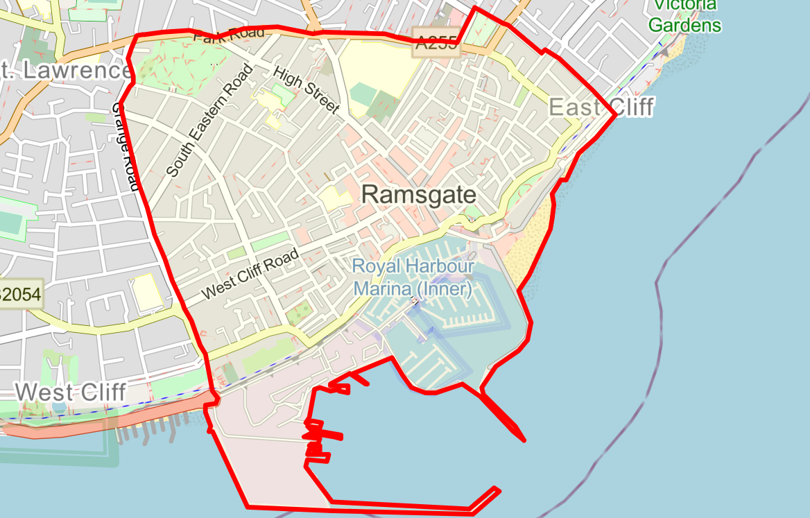
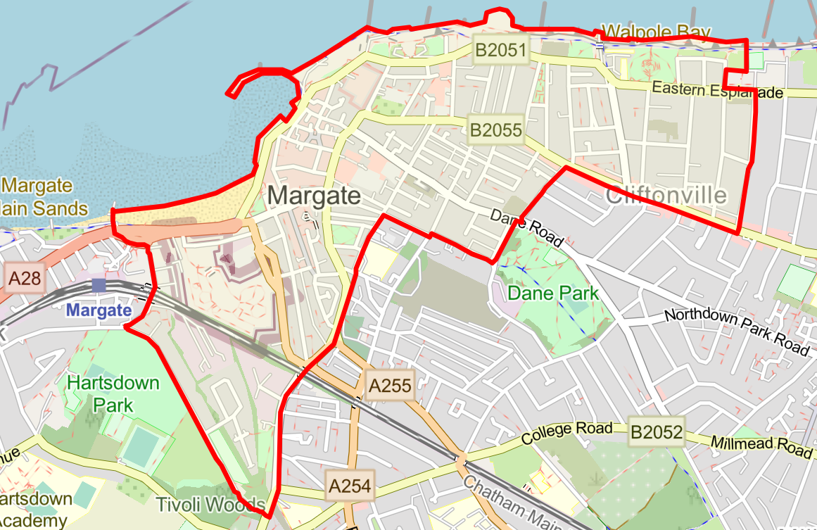
- i. consuming, or having an open container for alcohol in the “Margate High Street and Ramsgate High Street” Restricted Area(s) (Schedule 1).
- ii. Behaving in a manner which causes harassment, alarm or distress upon the consumption, or suspected consumption of, alcohol (Schedules 1 and 2).
- iii. Failing to comply with a direction not to consume, in breach of this order, alcohol, or anything which an authorised person reasonably believes to be alcohol, or where the authorised person reasonably believes that a person has engaged in anti-social behaviour (Schedules 1 and 2).
- iv. Failing to surrender a container of alcohol (whether open or not) when asked to do so by an authorised person (Schedules 1 and 2).
Urination/defecation
- v. Urinating or defecating in a place other than a serviced public convenience (Schedules 1 and 2).